
Details
Hit the road for sparkling beaches, dramatic coastline, funky towns, historic museums, lush rainforest, waterfalls, wineries and great pubs.


Sights & Activities


When you’re pining for the feel of sand between your toes, take the family and head to Wattamolla picnic area in Royal National Park.


Audley Dance Hall Cafe has a well-deserved reputation for serving wholesome cuisine at its venue in the heart of Audley in Royal National Park.


The Coast track in Sydney's Royal National Park is an epic multi-day walk between Bundeena and Otford.
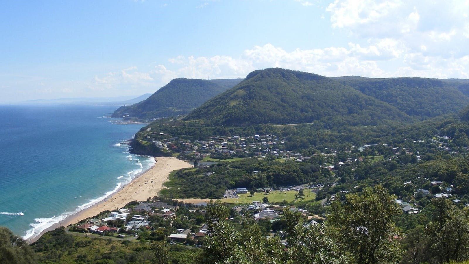

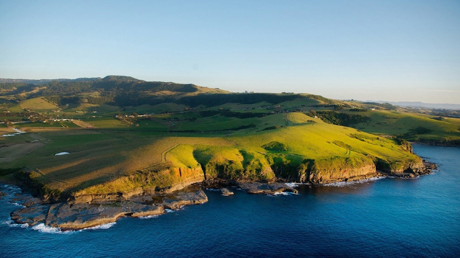
Bald Hill is one of Illawarra, Australia's most well known and most popular lookouts situated a top the hill of that name.


Sights & Activities


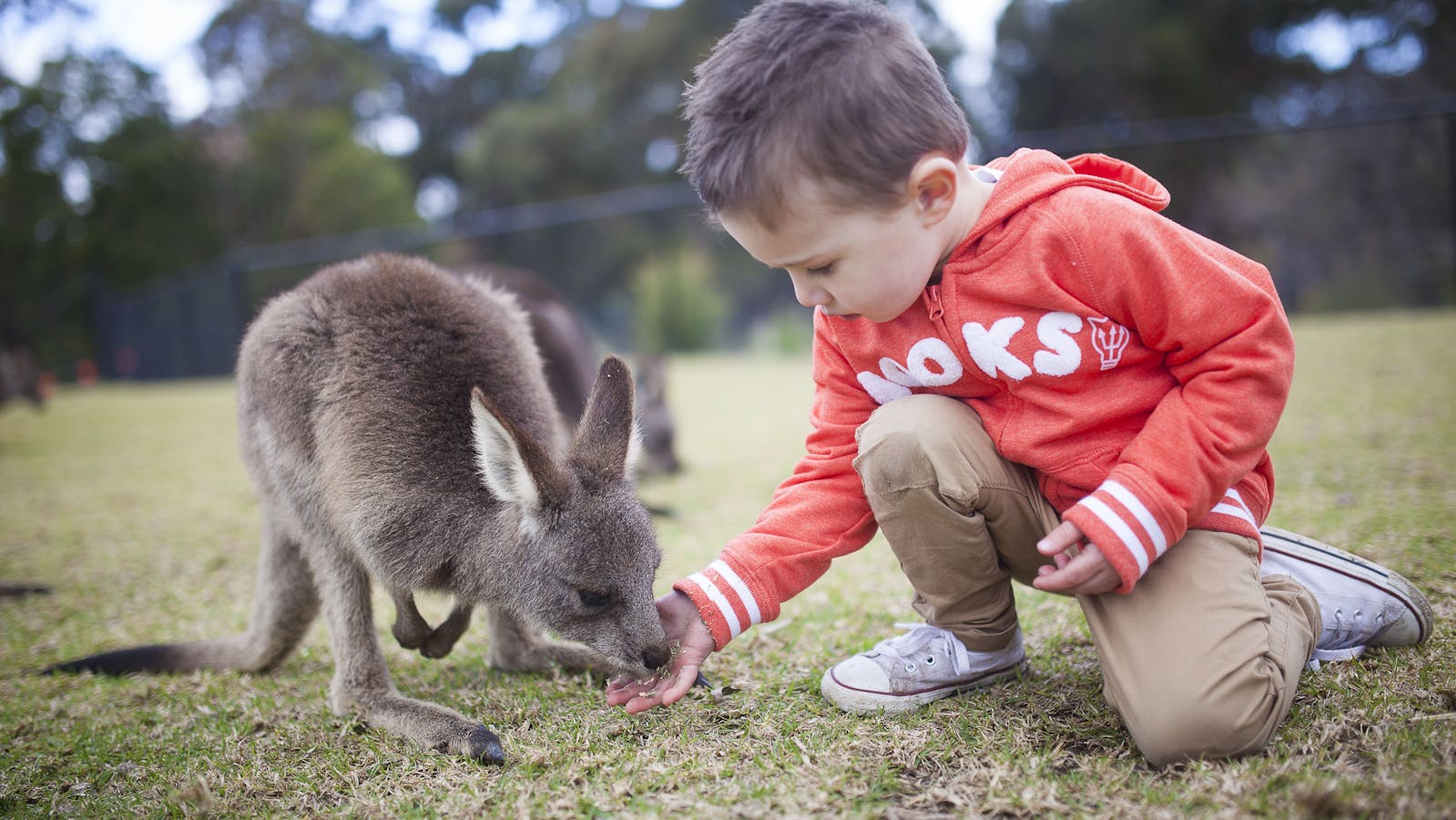

Discover your wild side at Symbio Wildlife Park, where you can meet some of Australia's (and the world's) most intriguing animals.
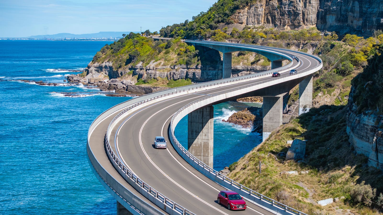

The 665 metre Sea Cliff Bridge is a highlight along the Grand Pacific Drive. The bridge has become an icon to the people of Wollongong.


Sublime Point Lookout offers 180 degree views over the sea, the rainforest and the 17 beaches that span the coastline to Wollongong.


Perched on the Illawarra escarpment’s cliff edge, you will find an outdoor garden overlooking the sea with views up the coast to Sydney.


Sights & Activities


Whether you’re a steel enthusiast, environmentalist, a ship lover, a traveller, or a local, Inside Industry has the tour for you.


Wollongong Art Gallery is a leading regional art gallery with an ongoing schedule of high quality exhibition, education and public programs.


Wollongong Harbour is the perfect spot to stop with the family to grab a bite to eat, while you are there explore the two lighthouses.


Immerse yourself in nature at the Wollongong Botanic Garden with their excellent network of paths to explore and hidden treasures to discover.


Mount Keira is a local landmark of Wollongong, towering 463.9 metres high and casting its protective shadow over this beautiful city.
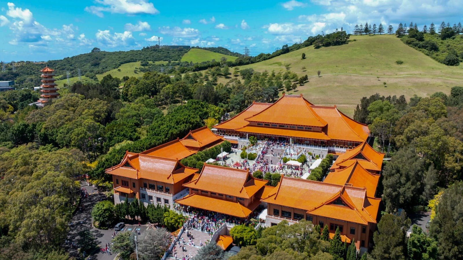

Visit or stay at Nan Tien Temple, the largest Buddhist Temple in the Southern Hemisphere.


Sights & Activities


Killalea State Recreation Park is a spectacular tract of coastal land that has been dedicated as a public recreation reserve available for surfing, fishing, picnics,


Lake Illawarra is a large tidal lake with a surface area of 35 square kilometres, and a 37 kilometres shoreline.


Bushrangers Bay is an aquatic reserve located in Bass Point Reserve, just south of Shellharbour Village. This is an excellent sheltered dive and snorkelling site.


HARS is located at Shellharbour Airport, which just over one hours drive south of Sydney, providing access to many aircraft and restorations in progress.


For a varied and interesting walk, take the Clover Hill trail. This old logging route leads to Rainbow Falls and three smaller falls upstream


Kiama's glorious Saddleback Mountain offers a photographers dream, with the elevated Saddleback Mountain Lookout.


Sights & Activities


Built in 1881, step into Kiama's past and discover the maritime and regional museum.


Kiama's famous Blowhole is the largest in the world! A viewing platform with disabled access provides outstanding views of the Kiama Blowhole.


The Little Blowhole is a little bit hard to find, but well worth the effort, situated just off Tingira Crescent.


Located just three kilometres north of Kiama at the southern end of Jones Beach, this distinctive rock formation is part of the geologically fascinating coastline.

The spectacular 20 kilometre Kiama Coast Walk hugs the edge of the continent as it guides you from Minnamurra River in the north.
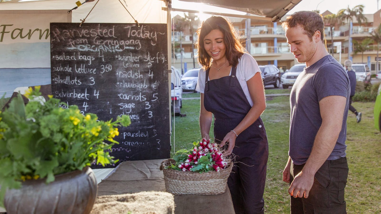

This is a true farmers’ market, where the origin of food and the protection of local growers, producers and makers are cared about.


Crooked River flows into the northern end of Seven Mile Beach at Gerroa, a short drive south of the coastal towns of Kiama and Gerringong.


Sights & Activities


Meroogal has survived to make its contribution to the study of our social history.


Wander through the English style gardens and iconic landscape that inspired one of Australia’s greatest artists Arthur Boyd, or enjoy a bushwalk.


Hike to Jerrawangala Lookout in Jerrawangala National Park for scenic views out to Gerroa, Ulladulla, Jervis Bay, St Georges Basin and Swan Lake. There are


Provides the local and surrounding communities with high-class entertainment, as well as being a venue for private parties, meetings, and general 'get-togethers'.


Pigeon House Mountain Didthul walking track is one of the best walks in Morton National Park and on the south coast.


Sights & Activities


Crystal-clear waters meet beautiful white sand beaches, while high cliffs and historic relics overlook the majestic Pacific Ocean. Extraordinary native wildlife with expansive botanic gardens.


The ruined Cape St George Lighthouse is perched on the edge of spectacular cliffs between Booderee National Park and the sea.


Huskisson Pictures is located in the seaside town of Huskisson, on the shores of Jervis Bay.


Visit Husky Pub at Huskisson Hotel for stunning views, local cuisine, refreshing drinks, and live entertainment on Thursdays, Fridays, and Saturdays.


The Jervis Bay Maritime Museum in Huskisson features a world renowned collection of maritime artefacts as well as navigational and surveying instruments.


The majestic Point Perpendicular Lighthouse is the crowning glory on the tip of a towering headland.
Using QR Codes
Open your Camera App or download a QR reader
Point your camera at the QR Code which will launch the correct app
Access websites and features such as maps and directions
Optional Downloads
GPX File
For use in apps such as GPS Navigation and wearable devices
KML File
For use in offline mapping products, such as maps.me and Google Maps
PDF File
A link to this document
Build your own itineraries
Alpaca provides a way for you to build your own itineraries. Visit https://alpaca.travel
Terms of Service and Attribution
Copyright Alpaca.travel, Mapbox.com and OpenStreetMaps
openstreetmaps.com.
Terms of Service
https://alpaca.travel/terms