Waterfall Way
Dangar Falls, near Dorrigo

Details

Open leg route
212.7KM / 132.2MI (Est. travel time 3 hours)
Fast chargers available along the route

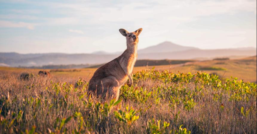
If the name of this road trip has you picturing rainbow-draped waterfalls and magical ferny valleys of rainforest, you’re not wrong.

From coastal Coffs Harbour to inland Armidale – with five stops along the way – this journey celebrates the wilderness and wonder of the NSW Mid North Coast.
Open in mobile
1
Coffs Harbour

Open in mobile
A kangaroo at Emerald Beach, Coffs Harbour
Get Directions
The Coffs Coast is your starting point for this epic day trip and you'll want to begin with a few adventures. In the town of Coffs Harbour, the Big Banana Fun Park welcomes you with a 13m banana sculpture (the original Big Thing); inside are attractions ranging from waterslides to a 4D simulator and mini-golf. Save some energy to hike around Muttonbird Island Nature Reserve (Giidany Miirlarl), a place of Aboriginal significance and an important nesting ground for migratory shearwaters.
The other migratory species you’ll see here are humpback whales, breaching and blowing between the Solitary Islands from June through October. For a loftier look, take the plunge with Coffs Skydivers, offering breathtaking – literally – views over the coast’s long stretches of sand.
Driving out of town, pause at Sapphire Beach to learn about the local Gumbaynggirr people on a Wajaana Yaam Adventure Tour, exploring the marine park and offering a taste of bush tucker. Navigate inland for 15min to Sealy Lookout (Niigi Niigi) – from the Forest Sky Pier, 15m above ground, you can gaze over Ulidarra National Park and all the way to the coast. This is also your view at TreeTops, an adventure park with ziplining, Tarzan swings and trapezes.
The Big Banana
351 Pacific Highway, Coffs Harbour, New South Wales, Australia, 2450
Get Directions

Muttonbird Island Nature Reserve
Photo: Rob Cleary
Marina Drive, Coffs Harbour, New South Wales, Australia, 2450
1300 072 757
parks.info@environment.nsw.gov.au
Get Directions
Birdwatching

The Eastern lookout offers spectacular views of the Solitary Islands. Explore the area's Aboriginal cultural significance on a school excursion, or enjoy some whale watching

Niigi Niigi - Sealy Lookout
Forestry Corporation of NSW
Sealy Lookout Drive, Coffs Harbour, New South Wales, Australia, 2450
1300 655 687
visit@fcnsw.com.au
Get Directions
Accessible, Wheelchair Access, Free Entry
Pets Allowed, Public Toilet, Picnic Area
Picnic Area, Cafe
Pets Allowed, Public Toilet
Lookouts
Parking, Coach Parking
Accessible, Wheelchair Access, Caters for people who use a wheelchair.

Niigi Niigi (Sealy Lookout) in Orara East State Forest was Coffs Harbour's first eco-certified tourism attraction.

TreeTops Coffs Harbour
Treetops Adventure
Sealy Lookout Drive, Coffs Harbour, New South Wales, Australia, 2450
(02) 5626 5461
coffsharbour@treetopsadventure.com.au
Get Directions
Accessible
Public Toilet, Picnic Area
Picnic Area
Public Toilet
$38 ~ $69 AUD
Parking
Accessible

Treetop Adventure Park is a recreation activity in the tree tops, where participants slide down flying foxes, move from tree to tree on suspension bridges.

Coffs Skydivers
Coffs Skydivers
65 Albany Street, Coffs Harbour, New South Wales, Australia, 2450
(02) 6651 1167
bookings@coffsskydivers.com.au
Get Directions
Skydiving

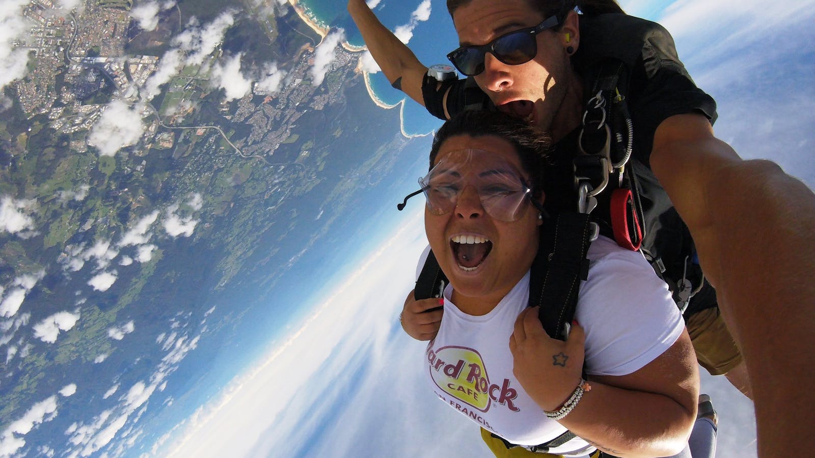
Love skydiving, love life. Coffs Skydivers is fun, energetic and professional.
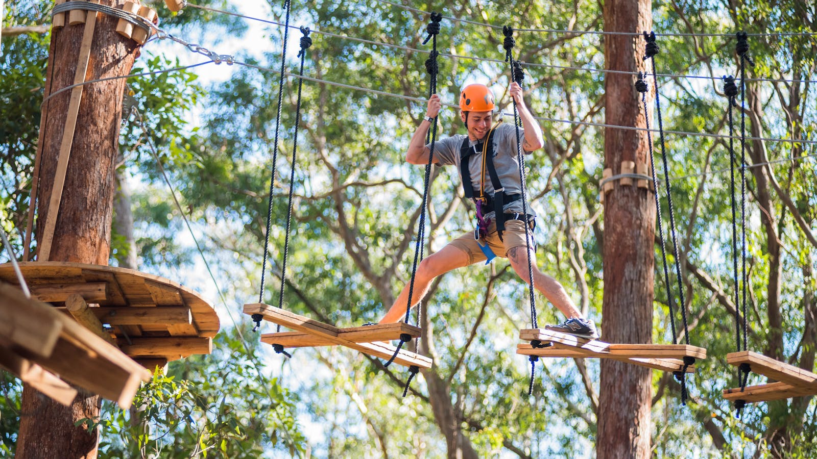
Wajaana Yaam Gumbaynggirr Adventure Tours
WYAT
19 Gaudrons Road, Coffs Harbour, New South Wales, Australia, 2450
0409 536 670
info@wajaanayaam.com.au
Get Directions

Wajaana Yaam Adventure Tours run tours in three amazing locations across the Coffs Coast.

2
Bellingen

Open in mobile
Kayaking on the Bellinger River, Bellingen
Arrive via car from Bellingen36KM / 22MI ~ Approximately 28 minutes
Get Directions
It’s a 30min drive south to Bellingen, your route weaving through Bongil Bongil National Park, home to one of NSW’s largest populations of koalas, as well as 165 species of birds. From here, follow the road west – you’re now officially on the Waterfall Way, enveloped by forest in the foothills of the Great Dividing Range.
The bohemian town of Bellingen is known for many things, a laid-back lifestyle, eclectic cafes and independent boutiques among them. But its namesake river steals the show, this 70km waterway snaking across numerous national parks as well as emerald valleys, where wide-eyed cows graze.
The best way to get a feel for this lush countryside is on the water, gliding (or splashing, depending on your energy levels) about with Bellingen Canoe Adventures. If you’re lucky you’ll spot the river’s critically endangered snapping turtles, as well as cormorants, wood ducks and figbirds.

Sights & Activities

Bellingen Canoe Adventures
4 Tyson Street, Fernmount, New South Wales, Australia, 2454
(02) 6655 9955
jody@canoeadventures.com.au
Get Directions

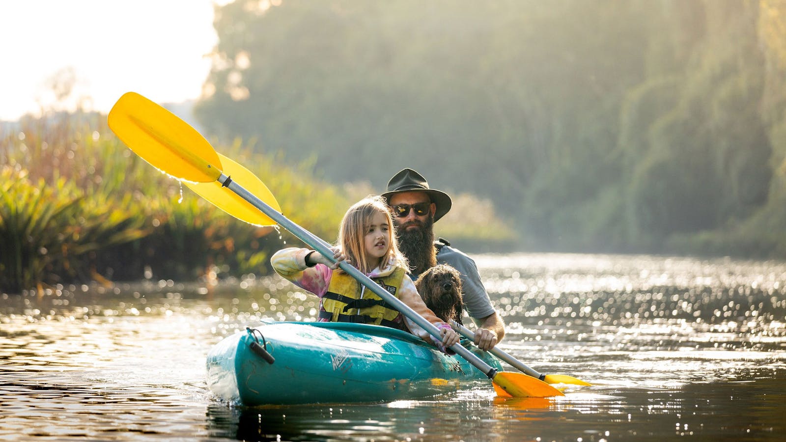
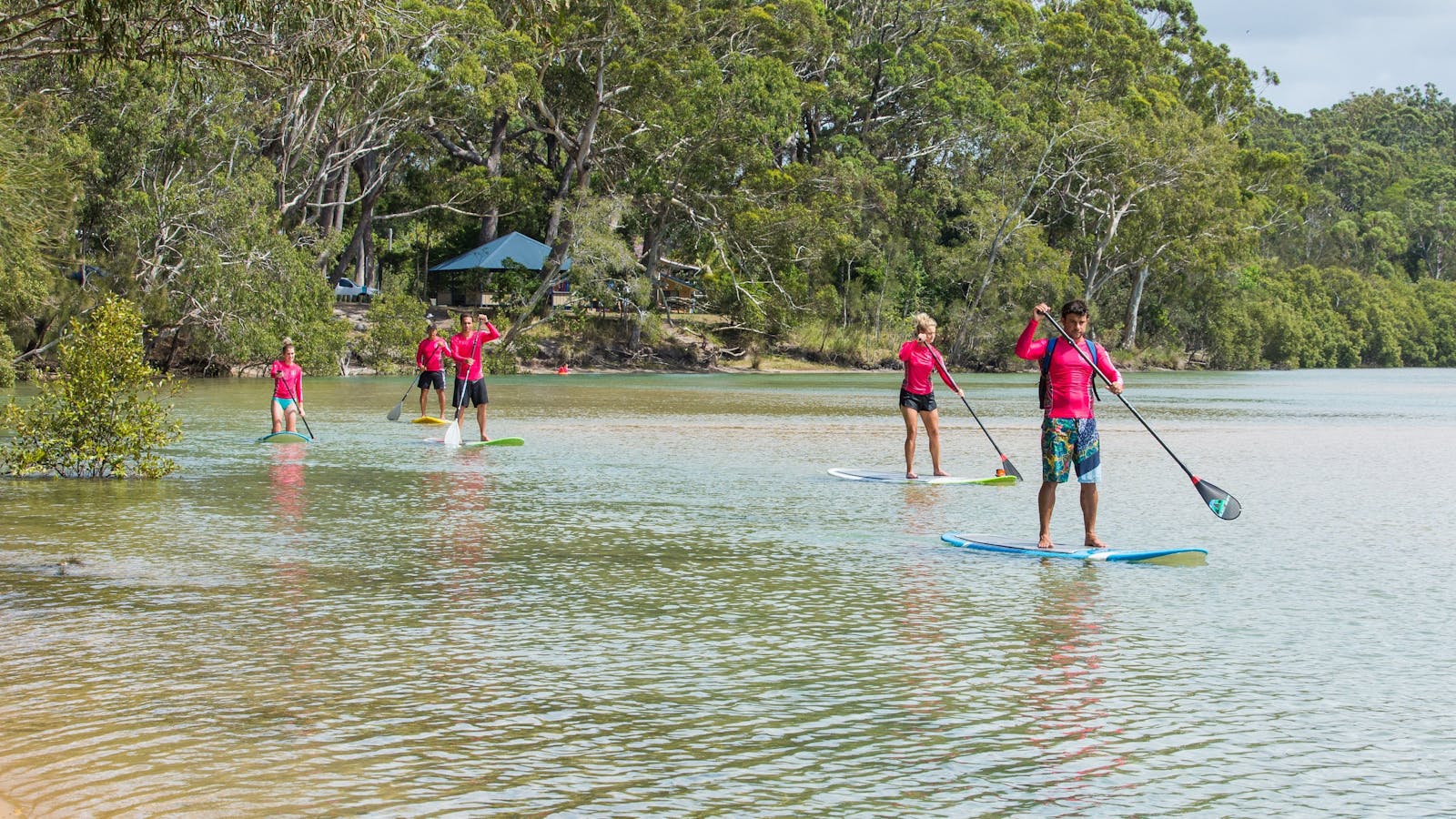
Bellingen Canoe Adventures offers canoe trips to all ages, from beginners to the more advanced - flatwater, whitewater, sunset and full moon tours are available.

3
Dorrigo National Park

Open in mobile
Dorrigo Skywalk in Dorrigo National Park
Arrive via car from Dorrigo National Park38KM / 24MI ~ Approximately 43 minutes
Get Directions
Your journey further west along Waterfall Way takes you deep into the heart of World Heritage-listed forest in Dorrigo National Park. This is part of the most extensive strip of diverse rainforest on the planet, and you’ll have a front-row seat on the Crystal Shower Falls Walk, a 3.5km loop that takes you over a suspension bridge, past ancient trees and behind a waterfall. Look out for lyrebirds and grey goshawks along your route.
For a bird’s-eye view, make a beeline for the Dorrigo Rainforest Centre and adjoining Skywalk. The former is the starting point for the region’s many hikes, with detailed maps and guides available to lead you on adventures through this truly humbling patch of wilderness. The latter is a 70m walkway through the tree canopy, 21m above the forest floor, your backdrop the peak of McGraths Hump and your outlook green valleys and gorges.
Dorrigo Rainforest Centre
NSW Government
Dorrigo National Park, Dorrigo Mountain, New South Wales, Australia, 2453
(02) 6657 5913
dorrigo.rainforestcentre@environment.nsw.gov.au
Get Directions
Accessible, Free Entry
Public Toilet, Picnic Area
Picnic Area
Public Toilet
Birdwatching, Walks
Accessible

Learn about the National Park's flora and fauna in the intriguing education area at the Dorrigo National Park Rainforest Centre.

Skywalk Lookout
Corner Dome Road and Lyrebird Lane, Dorrigo Mountain, New South Wales, Australia, 2453
1300 072 757
parks.info@environment.nsw.gov.au
Get Directions
Accessible
Non-smoking
Cafe, Barbeque, Kiosk
Lookouts
Parking
Accessible

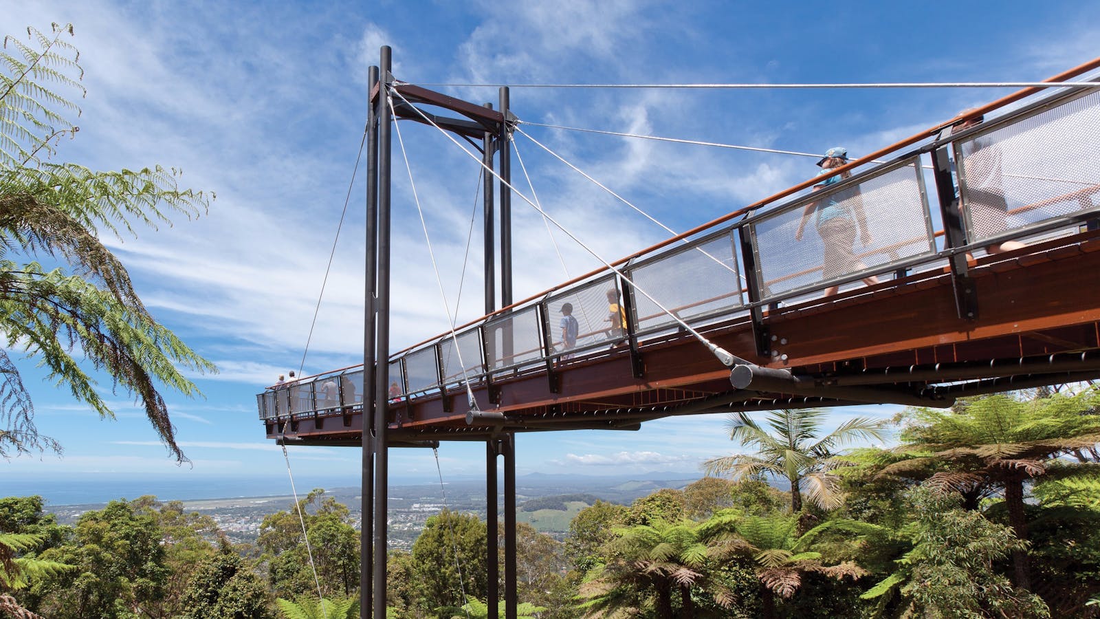
Directly connected to Dorrigo Rainforest Centre, Skywalk lookout offers a bird's-eye view of the surrounding landscape.

Wonga Walk
Photo: Rob Cleary
Lyrebird Lane, Dorrigo, New South Wales, Australia, 2453
Get Directions
Walks, Hiking

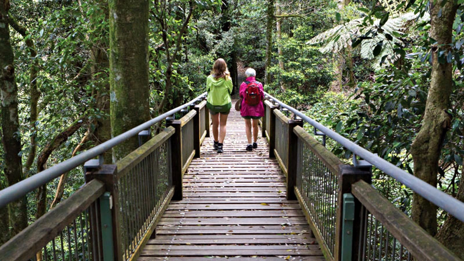
Take a walk amongst subtropical rainforest and 600-year-old trees along the Wonga walk in Dorrigo National Park, home to the Tristania and Crystal Falls. The

Crystal Shower Falls Walk
Photo: Rob Cleary
Lyrebird Lane, Dorrigo Mountain, New South Wales, Australia, 2453
Get Directions
Walks, Hiking

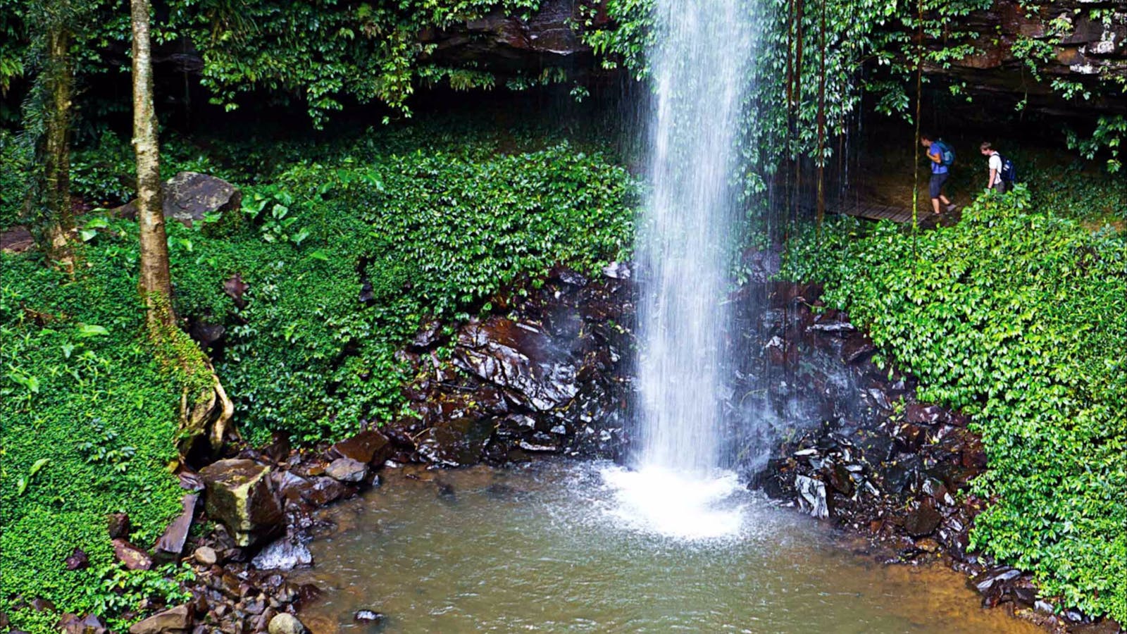
Walk through lush rainforest to reach Crystal Shower Falls in Dorrigo National Park near Coffs Harbour. Enjoy spectacular views from the rocky cavern behind the

4
Dorrigo

Open in mobile
Have a swim at Dangar Falls near Dorrigo
Arrive via car from Dorrigo13KM / 8MI ~ Approximately 24 minutes
Get Directions
The small town of Dorrigo in the Northern Tablelands is surrounded on almost every side by national parkland: its namesake to the east, where you’ve just come from, as well as Junuy Juluum to the north and Oxley Wild Rivers to the south. It’s an idyllic base for bushwalkers, who head off from here on treks through the dense subtropical rainforest.
Leave the town behind and, just 2km later, you’ll have a delicate mist settle over you at Dangar Falls. This place is like a pocket of Eden, the waterfall cascading 30m over basalt cliffs into a lagoon enveloped by mossy rocks. Whether you take this waterfall in from the elevated viewing platform or along the walking trail skirting its froth, this is one spectacular way to feel the force of NSW’s nature.

Sights & Activities

Dangar Falls
Coramba Road, Dorrigo, New South Wales, Australia, 2453
(02) 6655 1255
tourism@bellingenshire.nsw.gov.au
Get Directions
Lookouts

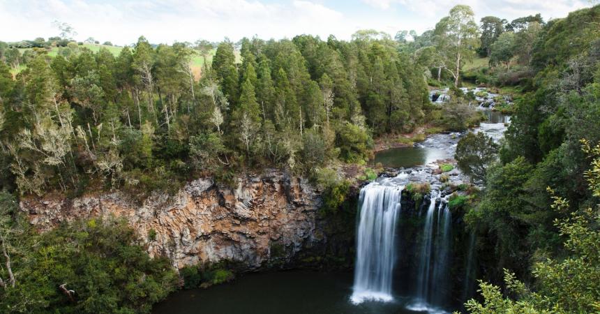
Two kilometres north of Dorrigo town centre is Dangar Falls, a beautiful 30-metre waterfall set amidst scenic agricultural and dairy farmland.

5
Ebor

Open in mobile
Ebor Falls on the Guy Fawkes River
Arrive via car from Ebor46KM / 29MI ~ Approximately 30 minutes
Get Directions
It’s a short and winding road west from Dorrigo through yet more rainforest to the village of Ebor. This is the heartland of the Waterfall Way, with easy access to countless national parks. To your south is New England National Park, its volcanic landscape of Gondwana forest-clad valleys and steep cliffs home to more than 100 species of birds. There are hikes that last anywhere from a few minutes to a few days.
Before you venture too far out of town, take a scenic pit stop at Ebor Falls. Here, the Guy Fawkes River thunders over cliffs, dropping 100m in two cascades. Pick your lookout: from where the water falls, mid-way down the drop or at ground level, giving you vast valley views. There’s a trail linking them, with seasonal orchids and everlasting daisies along the way.
Driving south you’ll pass through Cathedral Rock National Park, covered with wildflowers in spring and banksias year-round. Clamber over piles of enormous granite boulders at Cathedral Rock, an expanse reaching 200m high and extending more than a kilometre.
Ebor Falls
Destination NSW
Ebor Falls Road, Ebor, New South Wales, Australia, 2453
1300 072 757
parks.info@environment.nsw.gov.au
Get Directions
Accessible
Non-smoking
Barbeque
Lookouts
Parking
Accessible

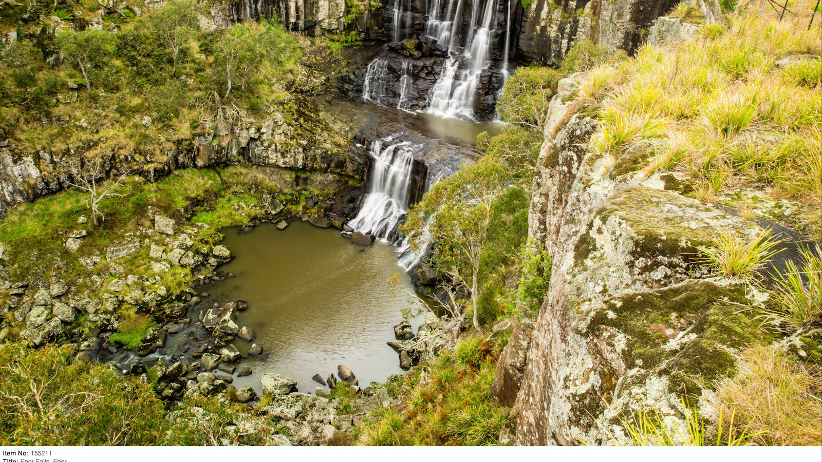
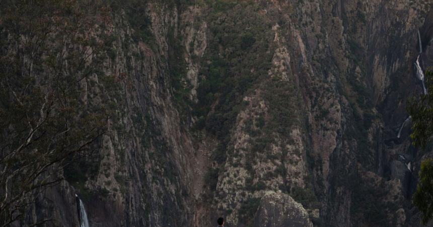
Watch the Guy Fawkes River plunging 100 metres over two waterfalls at Ebor Falls.

Cathedral Rock National Park
Cathedral Rock National Park, Ebor, New South Wales, Australia, 2453
Get Directions
Picnic Area
Picnic Area

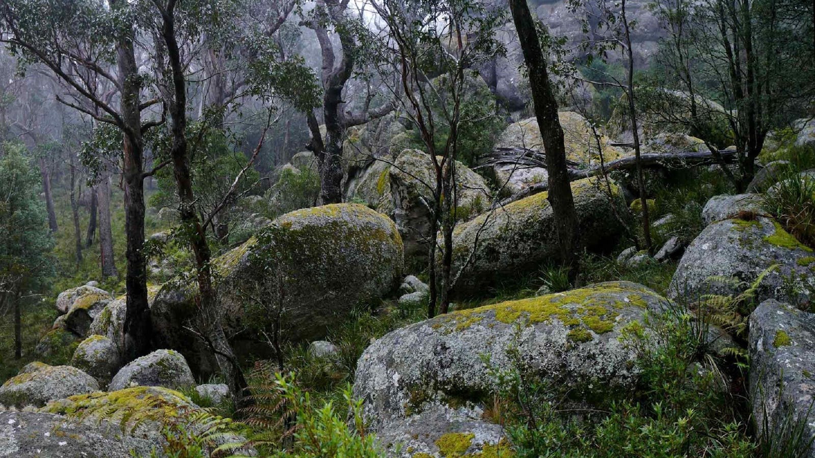
Camp, walk, birdwatch and enjoy scenic views with great picnic spots at Cathedral Rock National Park, just east of Armidale and west of Dorrigo on

New England National Park
Point Lookout Road, Brinerville, New South Wales, Australia, 2454
1300 072 757
parks.info@environment.nsw.gov.au
Get Directions
Accessible
Non-smoking, Picnic Area
Picnic Area
Camping, Scenic Drives, Swimming, Walks, Hiking, Lookouts
Accessible

Enjoy the spectacular natural beauty of New England National Park.

6
Wollomombi

Open in mobile
The lookout over Wollomombi Falls - Leah Pippos, NPWS
Arrive via car from Wollomombi39KM / 24MI ~ Approximately 24 minutes
Get Directions
It’s around 30km from Cathedral Rock to Wollomombi, a tiny village set high on the edge of the Oxley Wild Rivers National Park in the Northern Tablelands. This vast expanse of protected land is a dramatic union of ridges and gorges, rocky outcrops and rushing rivers, which tumble over the cliffs at Wollomombi Falls – the cascade can drop 220m after heavy rains.
Catch a glimpse from the lookout, or lace up your hiking boots and wander through World Heritage-listed forest of red gum and yellow box, home to the state’s largest population of brush-tail rock wallabies.
Set out on the Wollomombi Walking Track and your path will cross the Wollomombi River, a known habitat for the elusive platypus. When you reach the gorge, gaze skywards to see wedge-tailed eagles and peregrine falcons surfing thermals overhead, before the 4km trail ends at neighbouring Chandler Falls, smaller than Wollomombi but just as impressive.
Wollomombi Walking Track
Photo: J Lehmann
Wollomombi Falls Road, Hillgrove, New South Wales, Australia, 2350
Get Directions
Walks, Hiking

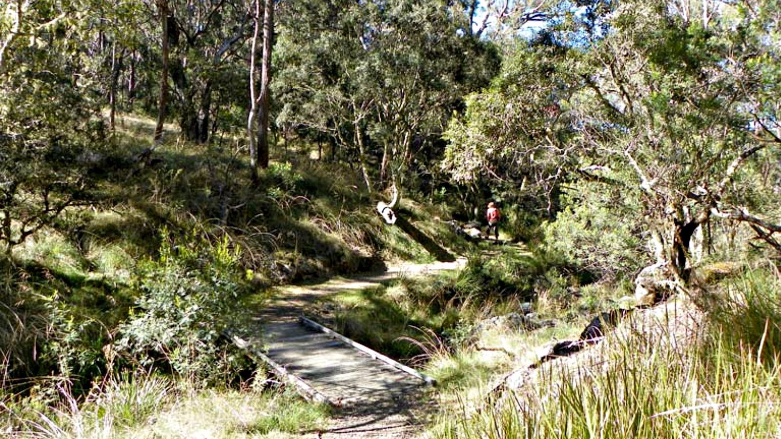
It’s all waterfalls and wilderness on this easy walk around the rim of the Wollomombi Gorge high in the falls country of the Northern Tablelands,

Wollomombi Falls
Armidale Regional Council
Oxley Wild Rivers National Park, Wollomombi, New South Wales, Australia, 2350
1300 072 757
parks.info@environment.nsw.gov.au
Get Directions
Accessible
Public Toilet, Picnic Area
Picnic Area, Barbeque
Public Toilet
Birdwatching, Walks, Hiking
Parking
Accessible

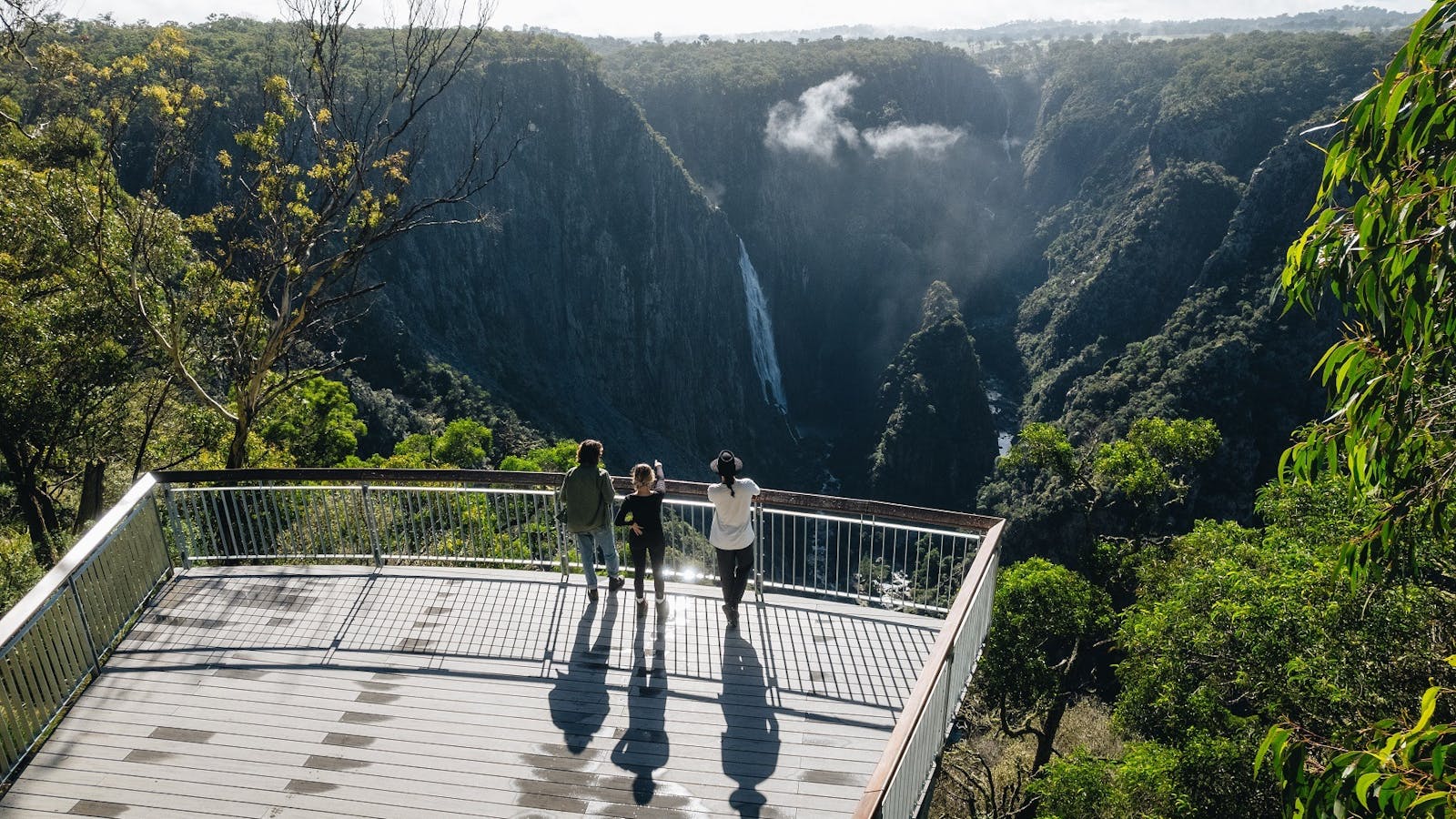
The Wollomombi Falls are one of the highest falls in Australia. The spectacular single fall from the undulating plateau country around Wollomombi to the floor.

7
Armidale

Open in mobile
Autumn colours across the city of Armidale
Arrive via car from Armidale41KM / 26MI ~ Approximately 28 minutes
Get Directions
Follow the Waterfall Way west for another 42km and you’ll reach your final destination on this road trip. Armidale’s leafy streets are lined with grand heritage buildings and churches – it’s known locally as the ‘Cathedral City’ for good reason.
The structure housing the New England Regional Art Museum is much more modern, however. The significant collection at this gallery covers Australian works from the 1880s to present day, uniting everything from abstract art to originals by landscape painter Arthur Streeton.
A full day of hiking, waterfall chasing, canoeing and culture seeking is thirsty work, so it’s a good thing the city has establishments like the Welder’s Dog. This popular microbrewery makes some of the tastiest fizzy beverages you’ll find in Australia, from a flavourful Indian pale ale to a zingy ginger beer and even a boozy lemonade infused with pea blossoms.
New England Regional Art Museum
106 -114 Kentucky Street, Armidale, New South Wales, Australia, 2350
(02) 6772 5255
office@neram.com.au
Get Directions
Accessible, Ambulant Access, Wheelchair Access
Ambulant Access, Public Toilet, Parents Room, Non-smoking, Picnic Area
Picnic Area, Cafe
Public Toilet
Parking, Coach Parking
Accessible, Ambulant Access, Wheelchair Access, Accessible for Hearing Impairment, Caters for people with sufficient mobility to climb a few steps but who would benefit from fixtures to aid balance. (This includes people using walking frames and mobility aids) Caters for people who use a wheelchair. Caters for people who are deaf or have hearing loss.

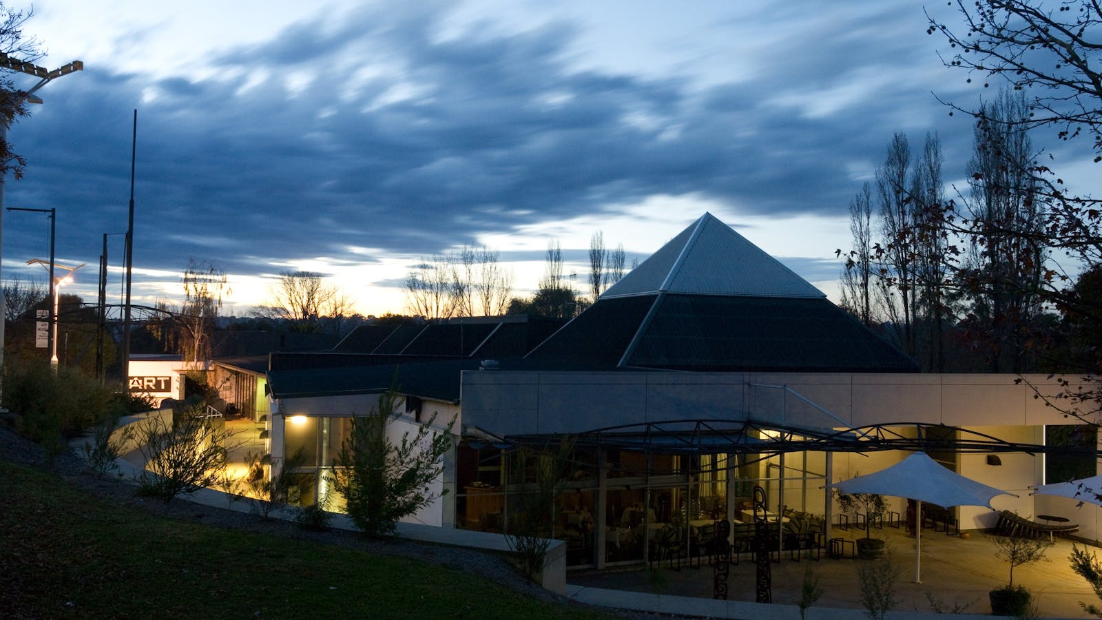
The New England Regional Art Museum (NERAM) is the public regional gallery located in Armidale in the heart of the New England North West region

The Welders Dog
The Welders Dog
120 Marsh Street, Armidale, New South Wales, Australia, 2350
0423 200 699
Get Directions
Accessible, Ambulant Access
Ambulant Access
Accessible, Ambulant Access, Caters for people with sufficient mobility to climb a few steps but who would benefit from fixtures to aid balance. (This includes people using walking frames and mobility aids)

Experience a huge range of craft beverages, local, regional, international craft beers and local award winning wines and spirits.

Using QR Codes

Open your Camera App or download a QR reader

Point your camera at the QR Code which will launch the correct app

Access websites and features such as maps and directions

Optional Downloads

GPX File

For use in apps such as GPS Navigation and wearable devices

KML File

For use in offline mapping products, such as maps.me and Google Maps

PDF File

A link to this document

Build your own itineraries

Alpaca provides a way for you to build your own itineraries. Visit https://alpaca.travel

Terms of Service and Attribution

Copyright Alpaca.travel, Mapbox.com and OpenStreetMaps openstreetmaps.com.
Terms of Service https://alpaca.travel/terms